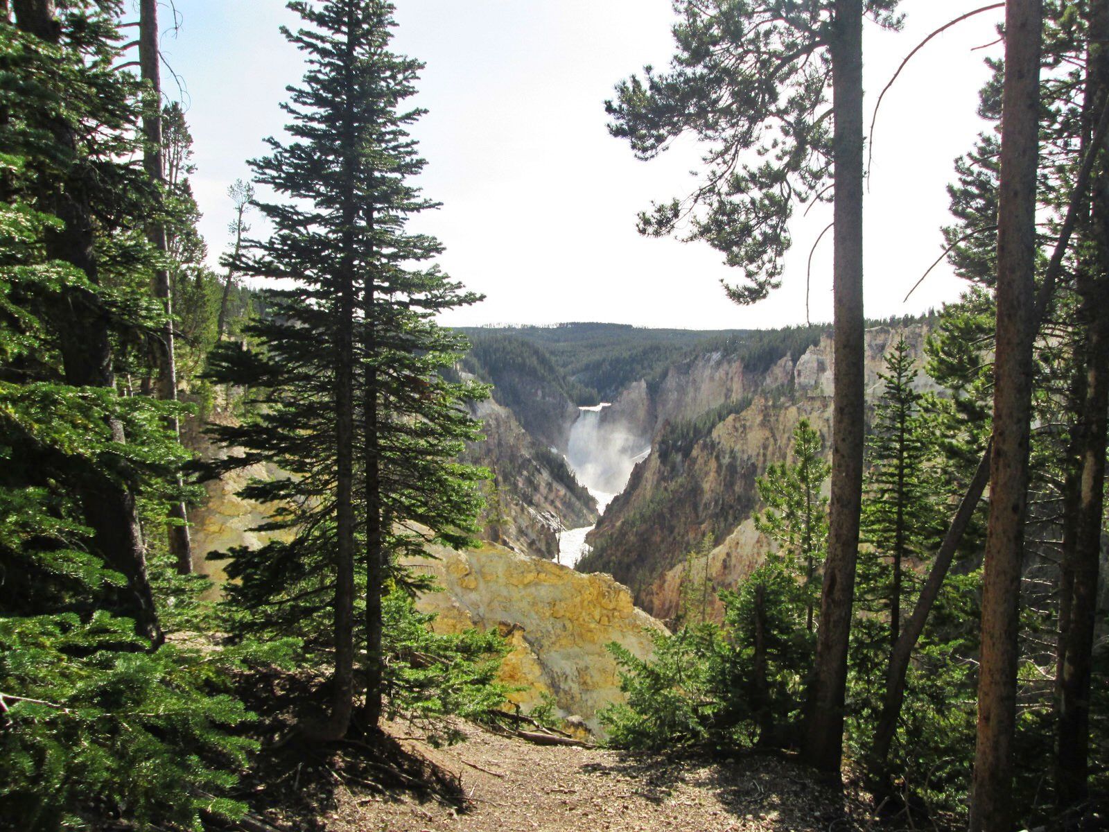
Yellowstone's Lower Falls is 308 ft. high and can be seen from various points on the South Rim Trail. The Lower Falls is often described as being more than twice the size of Niagara, although this only refers to its height and not the volume of water flowing over it. The volume of water flowing over the falls can vary from 63,500 gal/sec at peak runoff to 5,000 gal/sec in the fall.
Length: 9 Miles
Loop Trail: No
Primary Trail Type: Backcountry
Additional Trail Types: -
Agency: National Park Service
Entry Fee: -
Fee Notes: -
Parking Fee: -
Permit Fee: -
Trail Use Notes:
None
Seasonal Use Notes:
None
Location: In Yellowstone National Park along S rim of Yellow
County: Park
State: WY
Townships: -
Driving Directions:
-
Average Grade: -
Maximum Grade: -
Elevation High: -
Elevation Low: -
Elevation Gain: -
Average Width: -
Minimum Width: -
Primary Surface: -
Additional Surfaces: -
Year Designated: 1981